Welcome to the AppalachianTrailCafe.net!
Take a moment and register and then join the conversation

Hiking the Taconic Highlands- Beginner hiker

    This site uses cookies. By continuing to browse this site, you are agreeing to our Cookie Policy.

    • Hiking the Taconic Highlands- Beginner hiker

      Hi everyone- I am a bit new to the whole world of hiking. I am planning a small hike on the Taconic Highlands Trail, which I heard was 16.9 miles long. I was wondering if anyone knew where exactly you can pick this trail up and where exactly it ends. Also, is it relatively easy for a beginner hiker?

      Any feedback or suggestions are greatly appreciated.

      -MB ^^
    • Welcome to the cafe!
      Is this the trail you're asking about?


      "A high-elevation plateau ringed by cliffs and cascading waterways, the Taconic Highlands are home to old-growth forest, waterfalls, and a 17-mile stretch of the AT that doesn’t cross a single road. En route, it passes over the open summits of Mount Race and 2,624-foot Mount Everett, the second highest peak in Massachusetts. Eight designated shelters and camping areas, plus ready dayhiking access from Route 41 in the Housatonic Valley below, make for endless day-hiking options. Try the six-mile trip up the Race Brook Falls Trail, north over Mount Everett, and down the Elbow Trail."
      Lost in the right direction.
    • TrafficJam- Yes that's the one! From that description it seems a little advanced. I am wondering if it will be doable for a beginner hiker like myself. Mind you, I'm not the strongest person, but I am working to get physically fit for this hike.

      LIhikers- thank you! I will look this up more in detail.
    • According to AWOL's AT Guide, it starts at mile 1495 of the AT in Salisbury CT and ends at Jug End, mile 1512.

      There's parking at Undermountain Rd. (near Salisbury) and Jug End Rd, per the guide (check the ATC website to see if this is on the list of places where it's unsafe to park).

      Looking at the elevation profile and online descriptions of this section, it should be fairly easy for someone in moderate shape.

      I counted 4 shelters and 5 campsites (independent of shelters), and lots of streams and springs for water.

      Just looking at the guide, it looks like a great section for winging it and having fun...lots of camping choices and water sources so you can hike as far as you want and find a place to camp pretty quickly.

      Are you doing this as a day hike or overnight?
      Lost in the right direction.
    • CoachLou wrote:

      Okay....what I do know is ....the AT part is only a piece of it. The rest is a blue blaze to the west, up and across Taconic ridges in Connecticut , Mass and a blue blaze into New York. I will text Sarcasm to join this thread....I know he has been up there recently, and maybe Kevin also.
      I'm still uncertain, but I think mburbank1 is interested in the 17 mi stretch that is on the AT.
      Lost in the right direction.
    • It's a pretty section. The Race Cliffs do indeed have great views. It's fairly easy as the A-T goes, maybe a 4-5 on a scale where Maryland is a 1 and the Mahoosucs are a 10. But if you're a total newbie, that may look pretty @#$% hard. There are one or two spots of slab scrambling, which can be challenging if you're not used to it. The trail goes right up this rock, for instance. It's easier than it looks. There's a lot of texture that will hold a boot just fine. But you need to learn to balance with your weight centered over your boot or you'll slip, particularly if you do it in wet weather. There's nothing really dangerous. If you slip, you won't hurt much apart from your dignity. (At least if you don't do it in winter! Traction gear is strongly recommended if there's ice.)
      [IMG:https://farm6.staticflickr.com/5515/10600284343_bdebb240cb_z.jpg]

      There's another great hike on the ridge to the west - the South Taconic Trail. There are more great views there. The shelter on that trail is the fire warden's cabin on Alander Mountain, where the fire tower was taken down some years ago. It runs from the Catamount ski area down the MA/NY border to the corner of the three states, then to Mt. Brace (where you can usually watch hang gliders in season), and then down to where it ends in the village of Millerton.

      You can link the two trails to make about a 40-mile loop, but that involves a few miles of bushwhack up at the north end. Bushwhacking is NOT for the beginner. I tried that section with 1azarus a few years ago and got bronchitis. We finished the whack, but I bailed out at Catamount and got a taxi back to my car in Connecticut. Snowshoeing is not fun when you're coughing and wheezing.

      The NY/NJ Trail Conference has a nice map of the area for sale:
      nynjtc.org/panel/south-taconic-trails-map

      Berkshire Natural Resources Council used to have a very, very pretty map of the range for sale, but their web site doesn't appear to offer it any more. The cartographer still has a JPEG of it on his personal site:
      pdcarto.com/common/STR.jpg

      A few more pics of the section:

      View from the Race cliffs:
      [IMG:https://farm9.staticflickr.com/8508/8525890251_db85912b56_z.jpg]

      Mt. Everett on snowshoes:
      [IMG:https://farm9.staticflickr.com/8235/8527005526_ce6905132b_z.jpg]

      Alander Mountain on the South Taconic Trail:
      [IMG:https://farm8.staticflickr.com/7447/10600045056_dfe96c338a_z.jpg]

      Elf knows more than I do about this area. He's up there often. I've just been a couple or three times.
      I'm not lost. I know where I am. I'm right here.
    • TrafficJam wrote:

      According to AWOL's AT Guide, it starts at mile 1495 of the AT in Salisbury CT and ends at Jug End, mile 1512.

      There's parking at Undermountain Rd. (near Salisbury) and Jug End Rd, per the guide (check the ATC website to see if this is on the list of places where it's unsafe to park).

      Looking at the elevation profile and online descriptions of this section, it should be fairly easy for someone in moderate shape.

      I counted 4 shelters and 5 campsites (independent of shelters), and lots of streams and springs for water.

      Just looking at the guide, it looks like a great section for winging it and having fun...lots of camping choices and water sources so you can hike as far as you want and find a place to camp pretty quickly.

      Are you doing this as a day hike or overnight?

      I am planning on doing it over a weekend with my sister. Do you think it's safe for two girls to do alone?
    • mburbank1 wrote:

      TrafficJam wrote:

      According to AWOL's AT Guide, it starts at mile 1495 of the AT in Salisbury CT and ends at Jug End, mile 1512.

      There's parking at Undermountain Rd. (near Salisbury) and Jug End Rd, per the guide (check the ATC website to see if this is on the list of places where it's unsafe to park).

      Looking at the elevation profile and online descriptions of this section, it should be fairly easy for someone in moderate shape.

      I counted 4 shelters and 5 campsites (independent of shelters), and lots of streams and springs for water.

      Just looking at the guide, it looks like a great section for winging it and having fun...lots of camping choices and water sources so you can hike as far as you want and find a place to camp pretty quickly.

      Are you doing this as a day hike or overnight?
      I am planning on doing it over a weekend with my sister. Do you think it's safe for two girls to do alone?
      You will be absolutely safe and sound.......parking should be no problem. Depending on the weather that area may even be crowded.
      Cheesecake> Ramen :thumbsup:
    • Alright, I'm just catching up here. You all are giving me far too much credit (which I do appreciate!), but to be honest I haven't heard of a Taconic Highlands Trail specifically. If we are in fact talking about the section of the A.T. that starts at the Rte. 41 parking lot in Salisbury CT and ends past Mt. Everett in Jug End park, then I'm fIrly familiar.

      TrafficJam wrote:

      According to AWOL's AT Guide, it starts at mile 1495 of the AT in Salisbury CT and ends at Jug End, mile 1512.

      There's parking at Undermountain Rd. (near Salisbury) and Jug End Rd, per the guide (check the ATC website to see if this is on the list of places where it's unsafe to park).

      Looking at the elevation profile and online descriptions of this section, it should be fairly easy for someone in moderate shape.

      I counted 4 shelters and 5 campsites (independent of shelters), and lots of streams and springs for water.

      Just looking at the guide, it looks like a great section for winging it and having fun...lots of camping choices and water sources so you can hike as far as you want and find a place to camp pretty quickly.

      Are you doing this as a day hike or overnight?
      Going by my fuzzy memory, Undermountain road will bring you up a ~2 mile trail that connects with the A.T. on the south side of bear mountain in the area of Brassie brook shelter. Parking at rte 41 in Salisbury, you would hike 5? miles on the A.T. to reach this same point.

      This section of trail is Moderate by A.T. standards, but I remember hiking it as a beginner and I would advise that you get in the mindset that it is tough but doable. This section is one of the most scenic hiked in southern New England and is well worth the work. I would personally recommend using hiking poles for it, the north side of bear mountain and south side of Mt. Everett are both quite steep and the poles are a huge help for your knees when you have to hike down one of them.

      There is only one gery short piece of that trail that makes me nervous, that is where the trail is on the edge of the ridge on Mt. race for a few feet. Just walk carefully and you will be fine.


      As Another Kevin mentioned that this section involves walking a lot of bare granite. If the granite is dry then this is very easy, if it is wet the walk carefully because it becomes fairly slippery. If I remember correctly, the granite slabs are in fairly safe places, so if you fall the worst that would happen is you'll have to get back up and keep going. ;) 
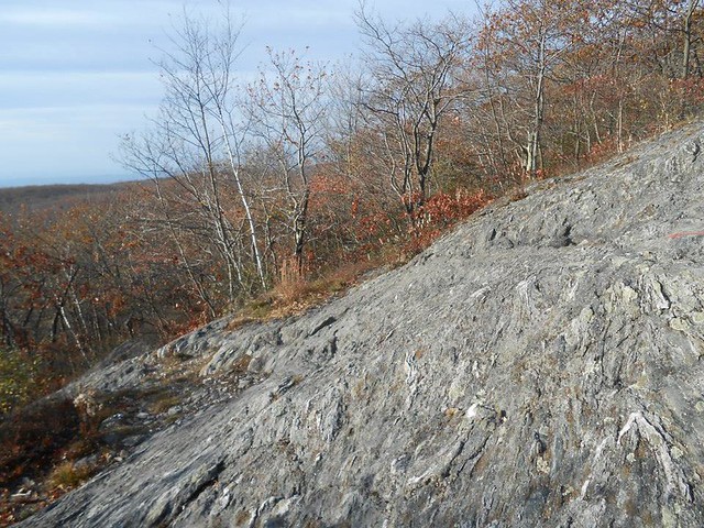
Also, be careful on the downhills if it's wet.

      On the plus side the views are great.


      mburbank1 wrote:

      TrafficJam wrote:

      According to AWOL's AT Guide, it starts at mile 1495 of the AT in Salisbury CT and ends at Jug End, mile 1512.

      There's parking at Undermountain Rd. (near Salisbury) and Jug End Rd, per the guide (check the ATC website to see if this is on the list of places where it's unsafe to park).

      Looking at the elevation profile and online descriptions of this section, it should be fairly easy for someone in moderate shape.

      I counted 4 shelters and 5 campsites (independent of shelters), and lots of streams and springs for water.

      Just looking at the guide, it looks like a great section for winging it and having fun...lots of camping choices and water sources so you can hike as far as you want and find a place to camp pretty quickly.

      Are you doing this as a day hike or overnight?
      I am planning on doing it over a weekend with my sister. Do you think it's safe for two girls to do alone?
      This part of CT/MA is very safe and surrounded primarily by affluent, artsy communities. I feel safer in those woods than I do walking around my hometown. Also I haven't heard of people having any problems leaving their car at the trailheads noted above.
      If you have time after your trip and feel like getting food, stop by Great Barrington and check out Gypsy Joynt, they're very hiker friendly. There is also an awesome pizza place called Baba Louie's that had a take out window inside the breezway of the building, of they're open when you get there I highly recommend it.
      Dogs are excellent judges of character, this fact goes a long way toward explaining why some people don't like being around them.
    • TrafficJam wrote:

      What they said. I feel safer hiking on the AT than running on my local greenways. However, I'm still always cautious and carry pepper spray.
      I prefer Tobasco, but to each their own... :D

      That said, I can't promise you that pepper spray is legal to carry in MA, they used to require a permit for it, then I heard they repealed that, then I heard there was question of whether they really did or didn't repeal it.
      Dogs are excellent judges of character, this fact goes a long way toward explaining why some people don't like being around them.
    • Oh! It just occurred to me that the original poster might be talking about a couple of other similarly named trails.

      The South Taconic Trail, I already discussed

      The Taconic Crest Trail runs from Jiminy Peak up to NY 346 on the NY/VT line a little bit south of Bennington. It mostly follows the NY/MA and NY/VT borders. It's another lovely trail, lots of good views, a little bit harder than the A-T section we've been discussing. It links to the Mahican rail trail at its northen terminus

      The Taconic Skyline Trail, some people use as a southern extension of the Taconic Crest Trail. It connects with the Taconic Crest trail just south of Jiminy and continues south to MA 41, about midway between West Stockbridge and the Hancock Shaker Village. (It's not a southern extension of the Taconic Crest Trail, really. It continues north from Jiminy and eventually links up with the trail network on Mt. Greylock.)

      Some of the local conservation organizations have a long-term goal of acquiring easements that would connect these trails into a unified Taconic Trail, but that's going to be a long road. On the NY side of the border, there are built trails through Beebe Hill and Harvey Mountain, and a couple of shelters in there, but the trails end abruptly at the border of the state land, with no connection to the Alford Spring wildlife management area about three miles farther south (with all private land in between). Then there's about ten miles through Alford and Egremont that's pretty near impossible to route. Another possible routing would be to try to connect over the Yokun Ridge, which would get a hiker to the Turnpike, and try to find a way around Stockbridge and Lee. There are already a bunch of trail easements on the ridge top. It might be possible to plot a route through the Agawam Lake and Monument Mountain reservations to come to the AT corridor near Great Barrington. All of these ideas are pipe dreams at present, but the organizations do what they can when they have the opportunity and the funding.
      I'm not lost. I know where I am. I'm right here.
    • mburbank1 wrote:

      Thank you to everyone for your feedback! I'm sorry that I didn't respond to everyone, but I read everything and have learned a lot from all of you. I'm still new to this forum thing so not sure how it works yet!
      mburbank1, glad to have you here! Hang around and you will figure it all out. You can learn a lot around here, and get a few laughs along the way. :)
      The road to glory cannot be followed with much baggage.
      Richard Ewell, CSA General