
I just hiked the NCT / Manistee River Trail loop. It is one of the most popular backpacking trips in MI. If you go on a weekend with perfect weather in peak color season (as I did), you will not be alone. I think every backpacker and day hiker in MI was there.
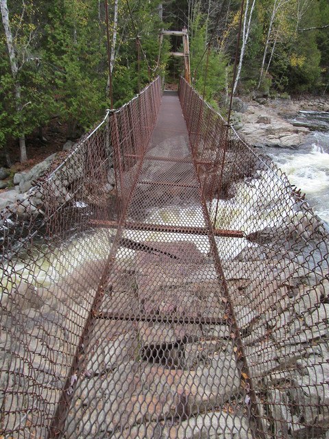
I started at Red Bridge at the southern end of the loop. The are parking areas on both sides of the river (south side of road). No permits are required and there are no fees if you park here. It's a 20.2 mile loop - about 10 miles up one side of the river and 10 miles back down the other side. I hiked the loop clockwise, up the short connecting trail to the NCT on the west side. The NCT follows a ridge in the trees so there are not many views and there are some ups and downs. But it is a very pleasant hike. There are no water on this section until you get to Eddington Creek just before the turn on to the MRT connector (pic 1) that takes you down to your first river view (pic 2). Soon you cross the pedestrian suspension bridge (pic 3) and hike down the other side. The river trail closely follows the river for 10 miles so there are numerous viewpoints where you can see the river and the ridge you hiked on the NCT earlier that day (pic 4). You are usually on a bluff above the river, but there are many water sources as you cross creeks and streams feeding into the river, including some small "waterfalls" (pic 5). There are also many downs and ups as you drop in and out of each drainage, but not big climbs. At large camping is allowed all along both sides. The MRT also has many designated campsites, most with views of the river. Some are shown on the on-line map, but at the trail heads there are maps that show the location of many more (I have not found an on-line version of this map). There are also many unofficial camp sites evident. I hiked about 17 miles the first day, camping on a bluff above the river (pic 6). The views on the short hike the following morning were especially good with the sun rising behind me (pic 7, 8).
michigantrailmaps.com/member-profile/3/127/
is0.gaslightmedia.com/michigan…s90-1397058756-13235.jpeg

